In the Breckland area many landscape features created by early man have survived into present times. Although ravaged by the natural elements of the weather, soil erosion, and vegetation growth, the poverty of the soils in this area means that arable farming and settlement has had less damaging effect than in places where the soils are more fertile. Other places in East Anglia where early landscape features survive are the sandy areas of the Suffolk and Norfolk coasts.
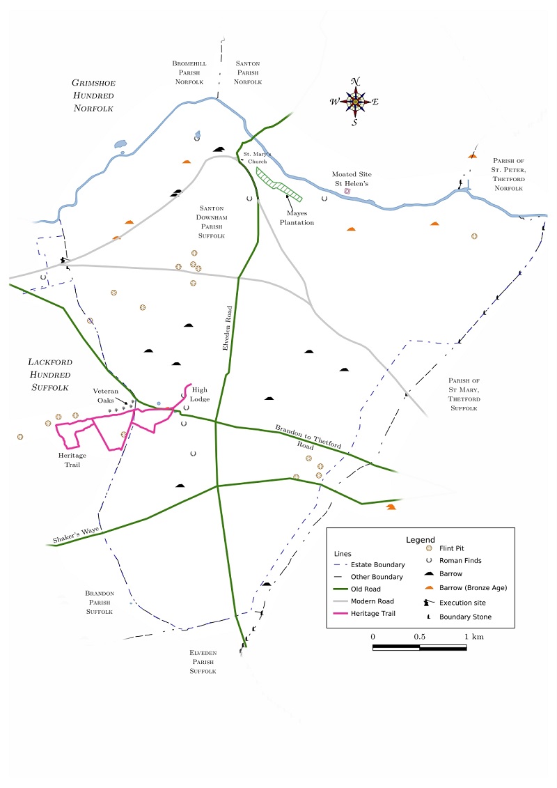
The burial mounds that have been identified in the High Lodge area are of the 'Round Barrow' type. Some are clearly visible to the observer, especially where they are 'looked after' to preserve their appearance. They appear as circular mounds slightly raised above the surrounding land, or occasionally basins. Some have been known for many years and some can be recognised from their names such as Weatherhill Oaks near High Lodge and Barrow Hill near Thetford. Many previously unknown barrows have been identified from the 2017 Lidar imaging in addition to those revealed in earlier aerial photographs such as those of 1946 and 1988. These appear as circular 'ring ditch' features. Some have been found by forestry operatives when clearing trees from plantations.
Several different types of round burial mounds have been identified as listed below. All are round but some are lower in the middle rather than higher. All have been eroded to a varying extent by the forces of nature and man.
Round barrows are thought to be between 2800 and 4500 years old. Built in a time called The Bronze Age when the bodies or cremated bones of important tribal leaders were buried in a place where they could be seen and remembered, and the lesser people were buried in mass graves. There have been few modern excavations, but in earlier centuries valuable goods such as a copper alloy dagger and spearhead, a gold bracelet, breastplate and three small boxes were found about 16 miles away at Little Cressingham, and a body placed on a small boat was found when excavating a barrow at Caistor St. Edmund along the route of the Norwich Southern Bypass.
At the present time there have been more than 25 barrows identified in the parish of Weeting, just a few miles north of the High Lodge Block. Today the barrows which have been positively identified are being protected from further damage. Those in forested areas such as Mount Ephraim, Weeting are cleared of trees, and regrowth of bushes and saplings is controlled. Unfortunately this makes them attractive to rutting deer and burrowing animals which can do damage. Others in arable fields such as those in the Little Cressingham area are fenced, or marked by posts and managed to allow grass to cover them.
Barrows, either long, square or round are thought to have been features of significance in the landscape. It is thought that these mounds were placed just below the brow of a hill or ridge, where they could be seen at a distance to be recognised and be venerated. Another theory that may be linked to the former is that they marked the boundaries between the territories controlled by different tribes or chiefs.
Before the Bronze Age, Neolithic long barrows were longer than their width, covering a mass of bones of many people. These may have been already picked bare, possibly in mortuary enclosures before burial. Round barrows are thought to have developed in the late Neolithic Age and continued through most of the Bronze Age. They reflect the development of a more settled society with an increased importance of land ownership and lines of ancestry in particular areas. Square barrows such as the one at West Acre have been dated to the Iron Age.
To read details of the individual burial mounds click on the button below:
More on Burial Mounds