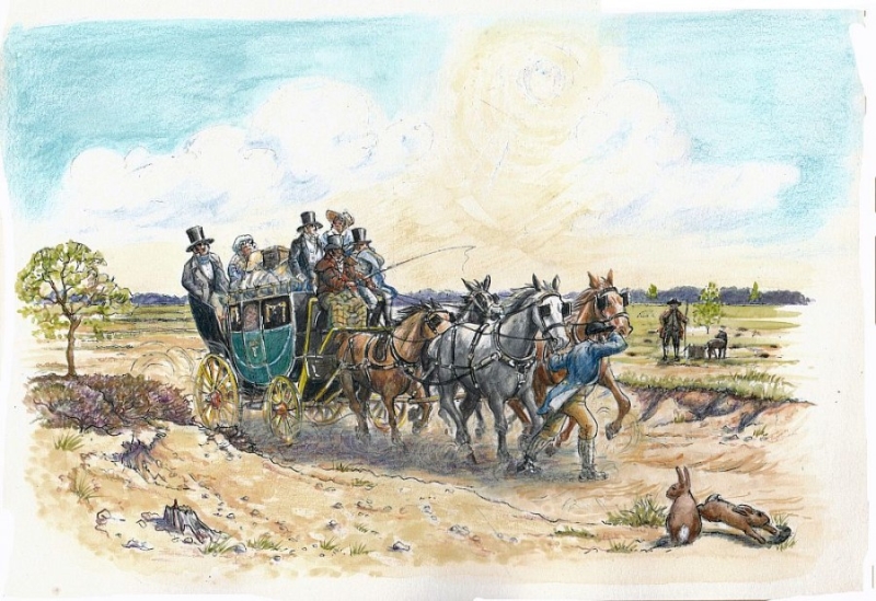
The sandy ground and progressive loss of vegetation through removal of the natural vegetation, cultivation and the trampling of animal and human feet made travel in the Breckland area very difficult at times.
Where are the sands and where is the warren?
Are not these scenes to my memory foreign?
Rabbits and conies were lords of the soil
Deep sands made the traveller's journey a toil.
– A poem by Lord Eldon, c.1830.
In the introduction to his book 'In Breckland Wilds' in 1921 WG Clarke wrote
before proper roads were made on these wastes there was a real danger in trying to follow the tracks under certain weather conditions … in the middle of the 18th century unenclosed land extended almost unbrokenly from Attleborough to Mildenhall … roads were few but tracks innumerable, branching off one from the other and pursuing their erratic courses
The natural heath vegetation would never have made a major obstacle to travel over the land, likewise the light sandy soil covering permeable chalk rock would have provided a natural drainage. Also the headwaters of fenland rivers such as the Little Ouse and the Lark and their tributaries provided a means of transport, especially heavy goods such as stone to the great religious buildings such as those at Thetford and Bury St. Edmunds, also agricultural and industrial goods were brought up, and sent down the rivers. Artificial channels known as Lodes were cut to settlements on the edge of the Brecks such as Lakenheath and Methwold to provide access these for boats.
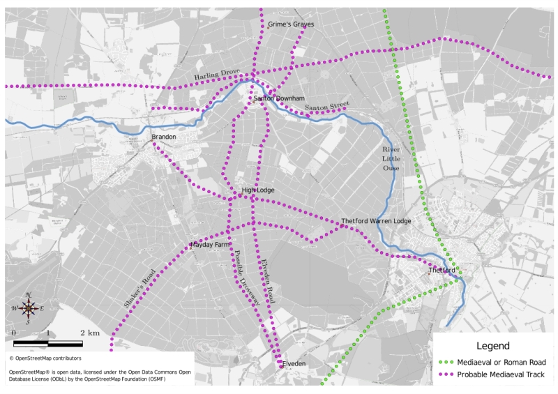
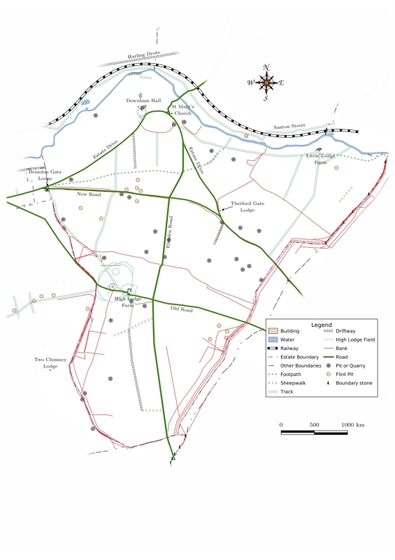
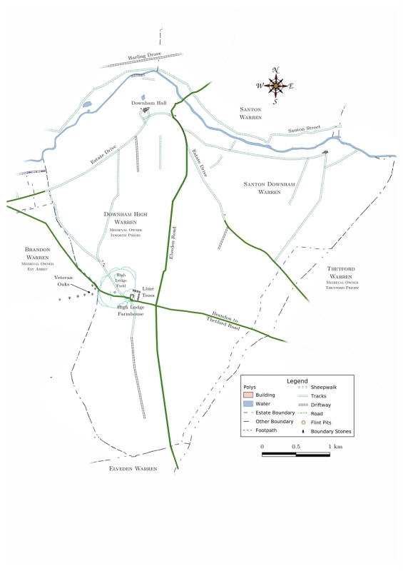
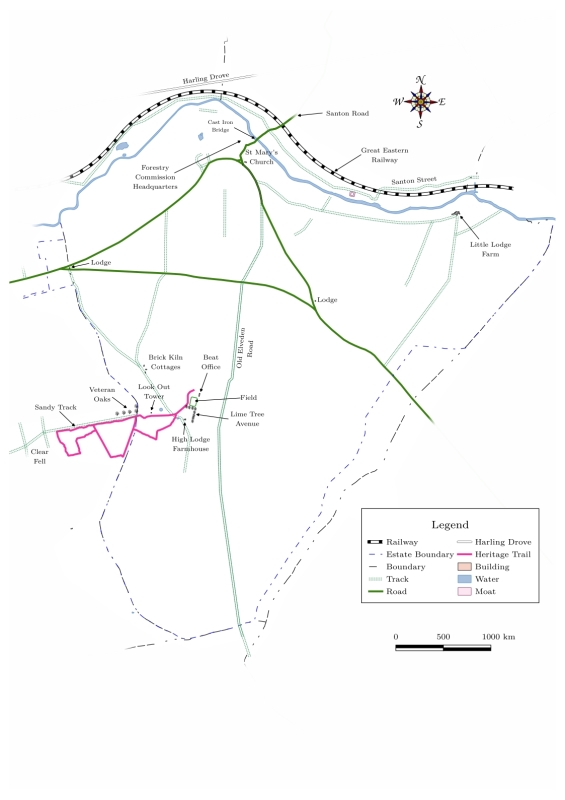
Although neither of these ancient routeways pass directly through the High Lodge area they may have influenced movement of trade, live animals and people over the centuries. The Icknield Way extends for 100s of miles from Wiltshire to North Norfolk. The Harling Drove connects the area around East Harling to Hockwold cum Wilton where it stops at the Fossditch.
Due to the importance of flint tools to early man it is thought likely that a trackway branched north-westwards from the Icknield Way to Grimes Graves, now in the parish of Weeting.
The poor Breckland soils were extensively grazed by sheep, great flocks of them, including the hardy Norfolk Horn – a great walker, were moved across the area, changing hands at sheep fairs such as Bromehill in July, and Brandon in June. Routes converged in places where great markets were held such as Broomhill near Weeting and Stanford, or where water could be found at the surface such as Ringmere and Fowlmere by the Harling Drove.
Large Sheep Fairs were held in places such as Stanford and West Tofts. These were major events lasting three or more days and became the focus of large and small trackways through local areas. Sheep and other animals were driven across the Brecklands, their droves established over the centuries leaving hollow ways where millions of hooves cut up the roots of vegetation and the loose sand was blown away by the wind. Today a stretch of the Harling Drove from Weeting to Croxton passes close to the High Lodge area, its path deeply etched into the ground. There were also wool fairs in Thetford and Bury St. Edmunds where the hides and fleeces would have been brought in on pack animals.
Otherwise known as the Little Ouse, this river connected the port of Kings Lynn to settlements on the edge of the fenland where the rising lands of Norfolk and Suffolk met the marshes. The shallow gradient of the river and its early tributaries caused its course to be somewhat variable and meandering before drainage of the Fenland starting in the 1500s. Until the installation of the first Denver Sluice the river was tidal as far as Hockwold and even Brandon, enabling reasonably deep-drafted boats to reach these settlements
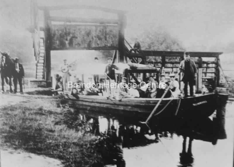
There are records of goods arriving by boat at Brandon in the 13th Century, and at Thetford in the 16th. It is probable that the Barnack stone used to build Thetford Priory and other religious buildings there was brought from Northampton by water.
The building of the first sluice at Denver in 1651 held back the tides and created an artificial base level that caused siltation and even slower river flow. It was improved for better navigation by a series of primitive locks or staunches from Lakenheath to Thetford, the earliest in 1670 and these continued to be maintained until the early 1900s. By this time the Fisons company at Thetford was still using lighters to Kings Lynn to carry its fertilisers, and William John Murrell of Brandon owned a company transporting various goods including coal by river in the Fenland area. In 1884 Charles Burrell, best known for building traction engines at Thetford built a number of steam-driven iron barges to carry its goods. One of these barges became The Nancy, a boat that later became the last passenger-carrying vessel on the Cam and Great Ouse.The last cargoes carried into the mid 20th century were fuel-oil to fenland pumping stations and sugar beet to the factories at Ely, Wissington and Kings Lynn.
The sandy soil of the High Lodge area must have made the maintenance of permanent routes difficult. The lack of soil cover and a dry climate would have resulted in sand blows, or as known locally 'sand floods'. In a period of years between 1665 and 1670 during the Little Ice Age when the climate became colder and drier, Santon Downham suffered particularly badly from sandstorms which were reported by Thomas Wright, a resident of Downham Hall to have buried and overthrown houses in the village, and silted the river so that boat transport was limited
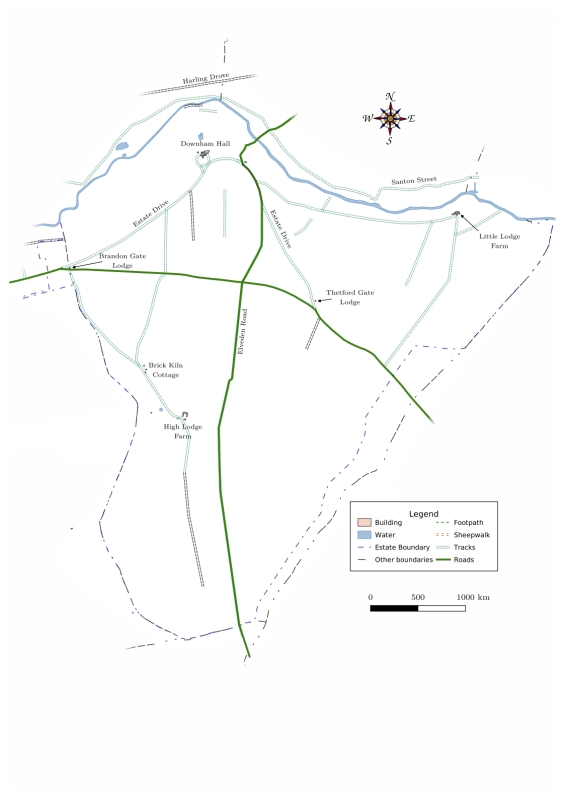
Some maps of the 18th and 19th century show through roads terminating in this Block, and others doubled or moved sideways. A significant change was made by law in the year 1800 when Justices of the Peace passed an Order to move the road from Thetford to Brandon to the north, away from Downham Lodge for about Three miles.
The fenlands to the north-west of Brandon limited travel in this direction. The lowest crossing point of the Little Ouse River was at Brandon. This provided a route northwards towards the Fen Causeway from Denver going back to at least Roman times, and a pilgrims road past Mount Ephraim, north of Weeting.
Until the 19th century the High Lodge area appears to have been crossed in both a north-south direction, from Santon Downham towards Elveden, and in a west-east direction from both Brandon and an area to the south of the town to Thetford. Maps drawn in earlier centuries show various tracks, disappearing and being replaced, or re-appearing.
A new road from Brandon to Thetford was created in 1800, enabling the local landowner to make private the old road from Brandon to his estate at Santon Downham.
From the early 18th century Turnpike Acts and improvements in road surfacing and drainage meant that better roads were established, with provision for their maintenance by tolls. These Turnpikes made travel more reliable and promoted regular transport services such as mail-coaches for passengers and post, and wagons for goods. Those listed below would have served businesses in the Brandon and High Lodge area.
1770 From Kings Lynn to Thetford turnpike. 1791 Brandon to Stoke Ferry (Nfk atlas) joining turnpike from Kings Lynn 1770 1792 Kings Lynn to Thetford? (Nfk atlas not through Brandon)
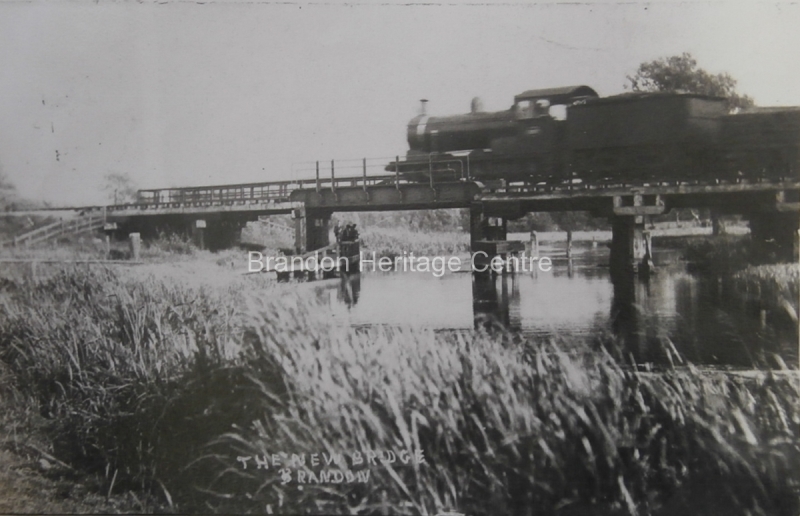
Brandon Railway Station opened on July 30th 1845 at the meeting place of two companies - the Norwich and Brandon Railway and the Eastern Counties Railway from Essex. This completed a route from Yarmouth to London. In the later times of British Rail, before privatisation in 1997 it was allowed to decline, but the modern start of an hourly service from Norwich to Cambridge in 2009, calling regularly at the station gave it a welcome revival. The track follows the curve of the river past Santon Downham, continuing mainly through forest to Thetford.
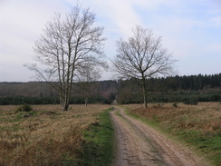
The only metalled roads of today are wide and straight, slicing through large tracts of forest. The B1107 from Brandon to Thetford and the B1106 from Brandon to Elveden pass north to south on either side of the High Lodge area. They cross several un-metalled ‘rides’, popular with walkers, horse riders and cyclists both within and outside the High Lodge area. These would have previously provided public and private access for the people to wider tracts of the area.
The railway flourishes as a busy commuter route to Ely and Cambridge where high-tech industry continues to develop. The growing towns of Wymondham, Attleborough and Thetford as well as Brandon supply more reasonably priced housing than Cambridgeshire.
The river is popular with boaters and there are moorings at the head of navigation in Brandon for a few boats. The former staunches which enabled navigation from Brandon to Thetford are now replaced by weirs.